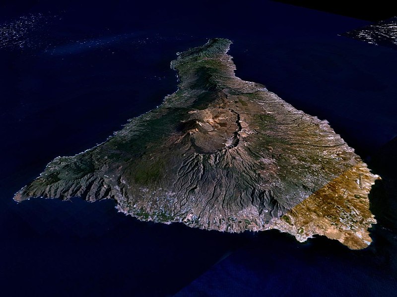
Vaizdas:Nasa world wind - teneriffa.jpg

Šios peržiūros dydis: 800 × 599 taškų. Kitos 4 rezoliucijos: 320 × 240 taškų | 640 × 479 taškų | 1 024 × 766 taškų | 1 280 × 958 taškų.
Pradinė rinkmena (1 280 × 958 taškų, rinkmenos dydis: 120 KiB, MIME tipas: image/jpeg)
Rinkmenos istorija
Paspauskite ant datos/laiko, kad pamatytumėte rinkmeną tokią, kokia ji buvo tuo metu.
| Data/Laikas | Miniatiūra | Matmenys | Naudotojas | Paaiškinimas | |
|---|---|---|---|---|---|
| dabartinis | 01:15, 31 kovo 2005 |  | 1 280 × 958 (120 KiB) | Simplicius | {{NASA-PD}} Teneriffa from the west side. One sees Teide (3,700 meters) and the Caldera (2,000 m). To the right hand the new airport. On the left side one sees that there is more humidity and therefore vegetation at the north side of the island. |
Rinkmenos naudojimas
Šis puslapis naudoja šią rinkmeną:
Visuotinis rinkmenos naudojimas
Ši rinkmena naudojama šiose viki svetainėse:
- Naudojama ar.wikipedia.org
- Naudojama be-tarask.wikipedia.org
- Naudojama cs.wikipedia.org
- Naudojama de.wikipedia.org
- Naudojama de.wikinews.org
- Naudojama de.wikivoyage.org
- Naudojama en.wiktionary.org
- Naudojama eo.wikipedia.org
- Naudojama es.wikipedia.org
- Naudojama fa.wikipedia.org
- Naudojama fi.wikipedia.org
- Naudojama frr.wikipedia.org
- Naudojama fy.wikipedia.org
- Naudojama gl.wikipedia.org
- Naudojama he.wikipedia.org
- Naudojama hu.wikipedia.org
- Naudojama it.wikipedia.org
- Naudojama mn.wikipedia.org
- Naudojama nn.wikipedia.org
- Naudojama no.wikipedia.org
- Naudojama pl.wiktionary.org
- Naudojama ru.wikipedia.org
- Naudojama sh.wikipedia.org
- Naudojama sk.wikipedia.org
- Naudojama sw.wikipedia.org
- Naudojama tr.wikipedia.org
- Naudojama uk.wikipedia.org
- Naudojama vi.wikivoyage.org
- Naudojama zgh.wikipedia.org
